ASSAM MIZORAM BORDER DISPUTE
ASSAM-MIZORAM BORDER DISPUTE

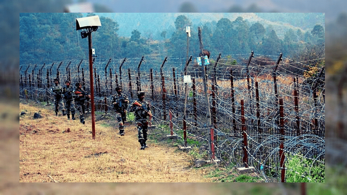
Assam-Mizoram Border Dispute recently came into the limelight following a violent clash between the residents of these two states in the border area. The recent clash occurred on October 17, 2020 when the residents of Lailapur village in Cachar district of Assam collided with the locals of Kolasib district of Mizoram. Earlier on October 9, a similar kind of clash took place at the border area between 'Karamp-imganj' district of Assam and Mamit district of Mizoram. The Assam-Mizoram Border conflict is not a new one but the dispute has persisted for long. Both the states share a 164.6 km inter-state border. Three Assam districts, namely, Cachar, Hailakandi and Karamp-imganj share their border with three Mizoram districts including Kolasib, Mamit and Aizawl.
RECENT CONFLICT BETWEEN THE TWO STATES
As per Mizoram's civil society groups, the locals of Lailapur village, Cachar district, Assam have pelted stones on the on-duty personnel of Mizoram Reserve Battalion. On the other hand, these charges have been refuted by the Police Officers of Assam. They state that a group of unidentified miscreants from Vairengte, Kolasib district of Mizoram burnt shops and hutments along the National Highway-306 (earlier NH-54) in Lailapur. Many believe that the incident is the outcome of the demolition of the makeshift hut which was used by the local volunteers near Saihapui V. The village is located near to Vairengte (Mizoram) and adjacent to Karamp-imganj (Assam). Amid the pandemic, these local volunteers were keeping a check on the movement of the people. The incident as described by the Mizoram civil society groups is a fight between illegal immigrants from Bangladesh. They have not described it as Assam vs Mizoram heat up. {Importance of NH-306: The highway is considered to be the lifeline of Mizoram, connecting it with the rest of India through Silchar, Assam}.
BACKGROUND OF ASSAM-MIZORAM BORDER DISPUTE

The boundary issue between present-day Assam and Mizoram dates back to the colonial era when inner lines were demarcated according to the administrative needs of British Raj. The issue could not be settled once and for all when the state was created in independent India. The result is both states continue to have a differing perception of the border.
Mizoram was granted statehood in 1987 by the State of Mizoram Act, 1986. Assam became a constituent state of India in 1950 and lost much of its territory to new states that emerged from within its borders between the early 1960s and the early 1970s. The Assam-Mizoram dispute stems from a notification of 1875 that differentiated Lushai Hills from the plains of Cachar, and another of 1933 that demarcates a boundary between Lushai Hills and Manipur. During colonial times, Mizoram was known as Lushai Hills, a district of Assam. Mizoram believes the boundary should be demarcated on the basis of the 1875 notification, which is derived from the Bengal Eastern Frontier Regulation (BEFR) Act, 1873. Mizo leaders have argued in the past against the demarcation notified in 1933 because Mizo society was not consulted.
The Assam government follows the 1933 demarcation, and that is the point of conflict. According to an agreement between the governments of Assam and Mizoram, the status quo should be maintained in no man’s land in the border area. In the Northeast’s complex boundary equations, clashes between Assam and Mizoram residents are less frequent than they are between other neighboring states of Assam, like with Nagaland.
The border between Mizoram and Assam is an imaginary line that changes with the naturally occurring obstacles of rivers, hills, valleys and forests. People of Assam and Mizoram have attributed the border conflicts to the differences over this not-so-clear boundary. People living in the border areas often cross over to the other side as they are not fully aware of the border demarcation.
OTHER BOUNDARY ISSUES IN NORTH-EAST
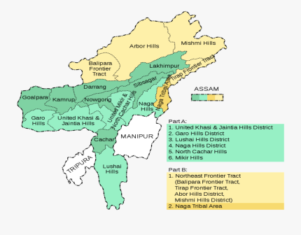
During British rule, Assam included present-day Nagaland, Arunachal Pradesh and Meghalaya besides Mizoram, which became separate states one by one. Currently, Assam has boundary problems with each of them.
ASSAM-NAGALAND
Nagaland shares a 500-km boundary with Assam. It achieved statehood in December 1963 and was formed out of the Naga Hills district of Assam and Arunachal Pradesh (then North-East Frontier Agency). Violent clashes and armed conflicts, marked by killings, have occurred on the Assam-Nagaland border since 1965. The boundary dispute is in the Supreme Court.
ASSAM-ARUNACHAL PRADESH
Both states have a boundary of over 800 km. Arunachal Pradesh was granted statehood by the State of Arunachal Pradesh Act, 1986 in 1987. Clashes were first reported in 1992 and since then, there have been several accusations of illegal encroachment from both sides, and intermittent clashes. This boundary issue is also being heard by the Supreme Court.
ASSAM-MEGHALAYA
The 884-km boundary between the two states also witnesses flare-ups. Meghalaya came into existence as an autonomous state within the state of Assam in April 1970 comprising the United Khasi & Jaintia Hills and the Garo Hills districts. In 1972, it got statehood. As per Meghalaya government statements, today there are 12 areas of dispute between the two states.
QUESTIONS (1-5)
Q.1 Which of the two North-Eastern states recently indulged themselves into a long dated conflict when there is a violent clash between locals of 'Lailapur village ' with the locals of Kolasib district of another state?
A. Assam-Arunachal Pradesh
B. Mizoram-Meghalaya
C. Nagaland-Manipur
D. Assam-Mizoram: ANSWER
Q.2 Currently, Which of the following persons are the Chief Ministers of Assam & Mizoram respectively?
A. Pema Khandu & Sarbananda Sonowal
B. Sarbananda Sonowal & Pu Zoramthanga: ANSWER
C. Sarbananda Sonowal & Shri Neiphiu Rio
D. N. Biren Singh & Conrad K Sangma
Q.3 Earlier before the year of Independence Mizoram was a part of Assam and it was known by which of the following names?
A. Lushai Hills: ANSWER
B. Phawngpui Hills
C. Kolasib Hills
D. None of the above
Q.4 Assam was granted statehood in the year of 1950 itself but in which of the following years does the Mizoram got the status of state under the Union of India?
A. 1963
B. 1967
C. 1987: ANSWER
D. 1991
Q.5 The Dispute over the boundary of Assam and Mizoram is about the clash between the two demarcation notification issued. Which of the following are these two?
A. Demarcation notification of 1950 v. Demarcation notification of 1987.
B. Demarcation notification of 1875 v. Demarcation notification of 1933: ANSWER
C. Demarcation notification of 1881 v. Demarcation notification of 1935.
D. None of the above


njyegrqgje
ASSAM MIZORAM BORDER DISPUTE njyegrqgje http://www.g27c6r0uh10fvybm16h42f56l4dz130vs.org/ [url=http://www.g27c6r0uh10fvybm16h42f56l4dz130vs.org/]unjyegrqgje[/url] <a href="http://www.g27c6r0uh10fvybm16h42f56l4dz130vs.org/">anjyegrqgje</a>
ogmzpddjig
ASSAM MIZORAM BORDER DISPUTE <a href="http://www.gm4m7m08bwd9626sd3o268tsu226b2aes.org/">aogmzpddjig</a> [url=http://www.gm4m7m08bwd9626sd3o268tsu226b2aes.org/]uogmzpddjig[/url] ogmzpddjig http://www.gm4m7m08bwd9626sd3o268tsu226b2aes.org/
bhnowdgdk
ASSAM MIZORAM BORDER DISPUTE <a href="http://www.gpxjfx256jg9c0r54j29so3p41o5d474s.org/">abhnowdgdk</a> bhnowdgdk http://www.gpxjfx256jg9c0r54j29so3p41o5d474s.org/ [url=http://www.gpxjfx256jg9c0r54j29so3p41o5d474s.org/]ubhnowdgdk[/url]
mqeglixfjl
ASSAM MIZORAM BORDER DISPUTE <a href="http://www.ggm96ml3fdw7ji518iw096yk45619ec2s.org/">amqeglixfjl</a> mqeglixfjl http://www.ggm96ml3fdw7ji518iw096yk45619ec2s.org/ [url=http://www.ggm96ml3fdw7ji518iw096yk45619ec2s.org/]umqeglixfjl[/url]
gbbhvkfwtm
Latest News on Education & LAW Exams Blogs | Success Mantra gbbhvkfwtm http://www.gf15zea83xct7d51o0jf91631rs59eb3s.org/ <a href="http://www.gf15zea83xct7d51o0jf91631rs59eb3s.org/">agbbhvkfwtm</a> [url=http://www.gf15zea83xct7d51o0jf91631rs59eb3s.org/]ugbbhvkfwtm[/url]
hxsyhwxkv
Latest News on Education & LAW Exams Blogs | Success Mantra <a href="http://www.gm375o7v6g225qfncpgk01r15m4c2h54s.org/">ahxsyhwxkv</a> [url=http://www.gm375o7v6g225qfncpgk01r15m4c2h54s.org/]uhxsyhwxkv[/url] hxsyhwxkv http://www.gm375o7v6g225qfncpgk01r15m4c2h54s.org/
bzzelkbv
Latest News on Education & LAW Exams Blogs | Success Mantra [url=http://www.ga9p6e3m6i46v39c89t7vejvaf3041i9s.org/]ubzzelkbv[/url] <a href="http://www.ga9p6e3m6i46v39c89t7vejvaf3041i9s.org/">abzzelkbv</a> bzzelkbv http://www.ga9p6e3m6i46v39c89t7vejvaf3041i9s.org/