CHINA'S NEW LAND BORDER LAW AMIDST STANDOFF
CHINA'S NEW LAND BORDER LAW AMIDST STANDOFF
Amid the military standoff with India in eastern Ladakh, China’s national legislature on October 23, 2021, adopted a new Land Border Law for the protection and exploitation of the land border areas. The law states that the sovereignty and territorial integrity of the People’s Republic of China are sacred and inviolable. The Land Border Law will come into effect from January 1, 2022. The Law reflects the growing confidence of China in its capability to manage its 22,000-km land border with 14 countries.
Current Affairs Notes By Success Mantra Coaching Institute GTB Nagar Delhi CLICK HERE
ABOUT THE NEW LAND BORDER LAW
- The Land Border Law was approved October 23, 2021, by the members of the National People’s Congress (NPC) Standing Committee at the closing meeting of the 31st session of the 13th NPC Standing Committee. The meeting was presided over by the NPC Standing Committee’s Chairman Li Zhanshu. President Xi Jinping signed orders to promulgate the law.
- Significance: The Land Border Law reflects the growing confidence of China in its capability to manage its 22,000-km land border with 14 countries including Russia, North Korea, Mongolia, India, and Bhutan. China has land border disputes with India (3,488-km along LAC) and Bhutan (400-km) while it has resolved boundary disputes with 12 countries. The Law comprises 62 Articles that stipulate measures to strengthen border defence, improve public services and infrastructure, support economic and social development in border areas, promote coordination between border defence and social, economic development, and encourage and support people’s life and work in border areas. The Law also stipulates establishing trade areas and border economic cooperation zones at the borders. It also states to improve the ecological environment in addition to maintaining flood and fire control and epidemic control along the border.
- The Law states that China shall follow the principle of equality, mutual trust, and friendly consultation. It will conduct negotiations with neighbouring countries to manage land border-related affairs and resolve longstanding border issues and disputes. Though the law also states that China can close its border if it recognizes a war or any armed conflict as a threat to its border security. The Law states the responsibilities of the military, state governments, and the State Council or Cabinet for the management of the economic and security issues in border areas. The law does not stipulate how to handle border security though the law stipulates that the Chinese military and military police will take measures to safeguard territorial integrity and land boundaries and guard against and combat any act that undermines territorial sovereignty and land boundaries.
- The People’s Liberation Army and the People’s Armed Police Force will guard against any “invasion, encroachment, infiltration, and provocation.” As per Article 22 of the Land Borders Law, the People’s Liberation Army (PLA) shall be responsible for ‘carrying out border duties’ including ‘organizing drills’ and ‘resolutely prevent, stop, and combat invasion, encroachment, provocation, and other acts.’
PRAVAHINI Current Affairs Notes By Success Mantra Coaching Institute GTB Nagar Delhi CLICK HERE
INDIA-CHINA BORDER DISPUTE
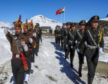
China has a 22,100-kilometer land border with 14 countries. It has resolved the boundary disputes with 12 neighbours. India and Bhutan are the two countries with which China is yet to finalise the border agreements. China and Bhutan signed an MOU firming up a three-step roadmap for expediting the boundary negotiations. India-China border disputes run 3,488-km along the Line of Actual Control (LAC). On June 15, 2020, the India-China border witnessed the worst violence since 1967 that killed 20 Indian soldiers. The clash occurred in the Galwan Valley which is strategically located between Ladakh on the Indian side of LAC and Aksai Chin on China’s side of the LAC. Following the clash in Galwan Valley, China claimed that the entire valley belongs to China while India termed the claim as exaggerated. As per experts and scholars, the LAC claims and territorial claims are different. The LAC claims refer to the territory which is under the effective control of each country. India refers to China’s claim to the entire Galwan Valley as unilaterally altering the LAC.
CONCERNS RELATED TO THE LAW
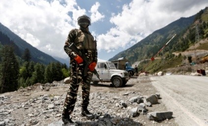
It would formalise some of China’s recent actions in disputed territories with both India and Bhutan. The passing of the law coincides with stepped up Chinese activity along the land borders, which have mirrored actions in disputed waters in the East and South China Sea. It includes the PLA’s massing of troops in forward areas along the India border and multiple transgressions across the Line of Actual Control (LAC). China in recent years has been strengthening border infrastructure, including the establishment of air, rail and road networks. It also launched a bullet train in Tibet which extends up to Nyingchi, the border town close to Arunachal Pradesh. The construction of new “frontier villages” along the border with Bhutan.
RECENT DISENGAGEMENT B/W TWO NATIONS
The agreement on Patrolling Point (PP) 17A (Gogra post) was reached but China is not inclined to move back from PP15 (Hot Springs area); it continues to insist that it is holding its own side of the Line of Actual Control (LAC). The disengagement at PP17A is likely to follow the process that was adopted for PP14 in the Galwan Valley and Pangong Tso where a time-frame was set for withdrawal. Both sides agreed to resolve these remaining issues in an expeditious manner in accordance with the existing agreements and protocols and maintain the momentum of dialogue and negotiations. They also agreed that in the interim they will continue their effective efforts in ensuring stability along the LAC in the Western sector and jointly maintain peace and tranquility.
PATROLLING POINT 15 AND 17A
Along the LAC between India and China, Indian Army has been given certain locations that its troops have access to patrol the area under its control. These points are known as patrolling points, or PPs, and are decided by the China Study Group (CSG). CSG was set-up in 1976, when Indira Gandhi was the prime minister, and is the apex decision-making body on China. Barring certain areas, like Depsang Plains, these patrolling points are on the LAC, and troops access these points to assert their control over the territory. It is an important exercise since the boundary between India and China is not yet officially demarcated. LAC is the demarcation that separates Indian-controlled territory from Chinese-controlled territory. PP15 and PP17A are two of the 65 patrolling points in Ladakh along the LAC. Both these points are in an area where India and China largely agree on the alignment of the LAC. PP15 is located in an area known as the Hot Springs, while PP17A is near an area called the Gogra post.
LOCATION OF HOT SPRINGS AND GOGRA POST
Hot Springs is just north of the Chang Chenmo river and Gogra Post is east of the point where the river takes a hairpin bend coming southeast from Galwan Valley and turning southwest. The area is north of the Karakoram Range of mountains, which lies north of the Pangong Tso lake, and south east of Galwan Valley.
Importance of Hot Springs and Gogra Post : The area lies close to Kongka Pass, one of the main passes, which, according to China, marks the boundary between India and China. India’s claim of the international boundary lies significantly east, as it includes the entire Aksai Chin area as well. Hot Springs and Gogra Post are close to the boundary between two of the most historically disturbed provinces (Xinjiang and Tibet) of China.
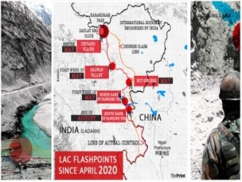
MAJOR FRICTION POINTS
- Apart from PP15 and PP17A, PP14 in Galwan Valley, and Finger 4 on the north bank of Pangong Tso and Rezang La and Rechin La on the south bank of Chang Chenmo river, were identified as friction points.
- Pangong Tso lake: Pangong Lake is located in the Union Territory of Ladakh. It is situated at a height of almost 4,350m and is the world’s highest saltwater lake. Extending to almost 160km, one-third of the Pangong Lake lies in India and the other two-thirds in China.
- Galwan Valley: The valley refers to the land that sits between steep mountains that buffet the Galwan River. The river has its source in Aksai Chin, on China’s side of the LAC, and it flows from the east to Ladakh, where it meets the Shyok River on India’s side of the LAC. The valley is strategically located between Ladakh in the west and Aksai Chin in the east, which is currently controlled by China as part of its Xinjiang Uyghur Autonomous Region.
- Chang Chenmo River: Chang Chenmo River or Changchenmo River is a tributary of the Shyok River, part of the Indus River system. It is at the southern edge of the disputed Aksai Chin region and north of the Pangong Lake basin. The source of Chang Chenmo is near the Lanak Pass.
- Kongka Pass: The Kongka Pass or Kongka La is a low mountain pass over a hill that intrudes into the Chang Chenmo Valley. It is in the disputed India-China border area in Ladakh.
- Karakoram Range: It is also known as Krishnagiri which is situated in the northernmost range of the Trans-Himalayan ranges. It forms India's frontiers with Afghanistan and China. It extends eastwards from the Pamir for about 800 km. It is a range with lofty peaks [elevation 5,500 m and above]. Some of the peaks are more than 8,000 metre above sea level. K2 (8,611 m) Godwin Austen or Qogir] is the second highest peak in the world and the highest peak in the Indian Union. The Ladakh Plateau lies to the north-east of the Karakoram Range.
WHAT IS LINE OF ACTUAL CONTROL?
Demarcation Line: The Line of Actual Control (LAC) is the demarcation that separates. Indian-controlled territory from Chinese-controlled territory.
LAC is different from the Line of Control (LoC) with Pakistan:
The LoC emerged from the 1948 ceasefire line negotiated by the United Nations (UN) after the Kashmir War. It was designated as the LoC in 1972, following the Shimla Agreement between the two countries. It is delineated on a map signed by the Director General of Military Operations (DGMO) of both armies and has the international sanctity of a legal agreement. The LAC, in contrast, is only a concept – it is not agreed upon by the two countries, either delineated on a map or demarcated on the ground.
Length of the LAC: India considers the LAC to be 3,488 km long, while the Chinese consider it to be only around 2,000 km.


0 Comment