
CONTROVERSY OVER CHINA'S NEW LAND BORDER LAW
CONTROVERSY OVER CHINA'S NEW LAND BORDER LAW
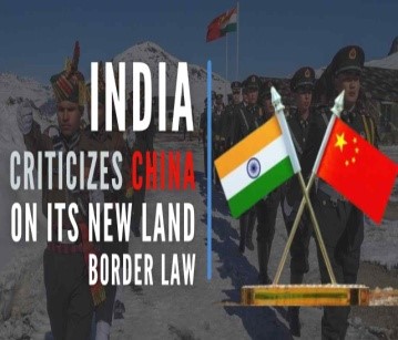
China’s new law on land borders came into effect from 1st January, 2022. It comes at a time when border standoff in eastern Ladakh remains unresolved and several places in Arunachal Pradesh have been renamed recently by China as part of its claim on the Indian state.
Delimitation and Survey of Land Borders:
The new law lies down that the People’s Republic of China (PRC) shall set up boundary markers on all its land borders to clearly mark the border.
Management and Defense of Border Areas: The People’s Liberation Army (PLA) and Chinese People’s Armed Police Force are assigned with the responsibility of maintaining security along the border.
This responsibility includes cooperating with local authorities in combating illegal border crossings. The law prohibits any party from indulging in any activity in the border area which would “endanger national security or affect China’s friendly relations with neighboring countries”. Even citizens and local organizations are mandated to protect and defend the border infrastructure. Finally, the law provides for the border to be sealed in the event of a war, armed conflict, incidents which threaten the security of border residents such as biological and chemical accidents, natural disasters, and public health incidents.
International Cooperation: On the topic of its border-sharing countries, the law lays down that the relation with these countries is to be based on principles of “equality and mutual benefit”. Further, the law provides for provisions for formation of joint committees, both civil and military, with the said countries to negotiate land border management and resolve border-related issues. The law also stipulates that PRC should abide by the treaties on land borders that it has signed with the respective countries and all border issues are to be settled through negotiations.
Current Affairs Notes By Success Mantra Coaching Institute GTB Nagar Delhi CLICK HERE
ABOUT THE NEW LAND BORDER LAW
- The Land Border Law was approved October 23, 2021, by the members of the National People’s Congress (NPC) Standing Committee at the closing meeting of the 31st session of the 13th NPC Standing Committee. The meeting was presided over by the NPC Standing Committee’s Chairman Li Zhanshu. President Xi Jinping signed orders to promulgate the law.
- Significance: The Land Border Law reflects the growing confidence of China in its capability to manage its 22,000-km land border with 14 countries including Russia, North Korea, Mongolia, India, and Bhutan. China has land border disputes with India (3,488-km along LAC) and Bhutan (400-km) while it has resolved boundary disputes with 12 countries. The Law comprises 62 Articles that stipulate measures to strengthen border defence, improve public services and infrastructure, support economic and social development in border areas, promote coordination between border defence and social, economic development, and encourage and support people’s life and work in border areas. The Law also stipulates establishing trade areas and border economic cooperation zones at the borders. It also states to improve the ecological environment in addition to maintaining flood and fire control and epidemic control along the border.
- The Law states that China shall follow the principle of equality, mutual trust, and friendly consultation. It will conduct negotiations with neighbouring countries to manage land border-related affairs and resolve longstanding border issues and disputes. Though the law also states that China can close its border if it recognizes a war or any armed conflict as a threat to its border security. The Law states the responsibilities of the military, state governments, and the State Council or Cabinet for the management of the economic and security issues in border areas. The law does not stipulate how to handle border security though the law stipulates that the Chinese military and military police will take measures to safeguard territorial integrity and land boundaries and guard against and combat any act that undermines territorial sovereignty and land boundaries.
- The People’s Liberation Army and the People’s Armed Police Force will guard against any “invasion, encroachment, infiltration, and provocation.” As per Article 22 of the Land Borders Law, the People’s Liberation Army (PLA) shall be responsible for ‘carrying out border duties’ including ‘organizing drills’ and ‘resolutely prevent, stop, and combat invasion, encroachment, provocation, and other acts.’
INDIA-CHINA BORDER DISPUTE
China has a 22,100-kilometer land border with 14 countries. It has resolved the boundary disputes with 12 neighbours. India and Bhutan are the two countries with which China is yet to finalise the border agreements. China and Bhutan signed an MOU firming up a three-step roadmap for expediting the boundary negotiations. India-China border disputes run 3,488-km along the Line of Actual Control (LAC). On June 15, 2020, the India-China border witnessed the worst violence since 1967 that killed 20 Indian soldiers. The clash occurred in the Galwan Valley which is strategically located between Ladakh on the Indian side of LAC and Aksai Chin on China’s side of the LAC. Following the clash in Galwan Valley, China claimed that the entire valley belongs to China while India termed the claim as exaggerated. As per experts and scholars, the LAC claims and territorial claims are different. The LAC claims refer to the territory which is under the effective control of each country. India refers to China’s claim to the entire Galwan Valley as unilaterally altering the LAC.
RECENT DISENGAGEMENT B/W TWO NATIONS
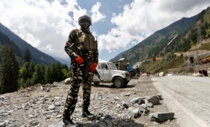
The agreement on Patrolling Point (PP) 17A (Gogra post) was reached but China is not inclined to move back from PP15 (Hot Springs area); it continues to insist that it is holding its own side of the Line of Actual Control (LAC). The disengagement at PP17A is likely to follow the process that was adopted for PP14 in the Galwan Valley and Pangong Tso where a time-frame was set for withdrawal. Both sides agreed to resolve these remaining issues in an expeditious manner in accordance with the existing agreements and protocols and maintain the momentum of dialogue and negotiations. They also agreed that in the interim they will continue their effective efforts in ensuring stability along the LAC in the Western sector and jointly maintain peace and tranquility.
PATROLLING POINT 15 AND 17A
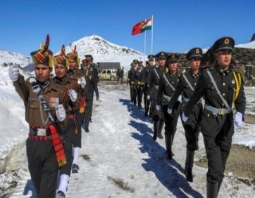
Along the LAC between India and China, Indian Army has been given certain locations that its troops have access to patrol the area under its control. These points are known as patrolling points, or PPs, and are decided by the China Study Group (CSG). CSG was set-up in 1976, when Indira Gandhi was the prime minister, and is the apex decision-making body on China. Barring certain areas, like Depsang Plains, these patrolling points are on the LAC, and troops access these points to assert their control over the territory. It is an important exercise since the boundary between India and China is not yet officially demarcated. LAC is the demarcation that separates Indian-controlled territory from Chinese-controlled territory. PP15 and PP17A are two of the 65 patrolling points in Ladakh along the LAC. Both these points are in an area where India and China largely agree on the alignment of the LAC. PP15 is located in an area known as the Hot Springs, while PP17A is near an area called the Gogra post.
LOCATION OF HOT SPRINGS AND GOGRA POST
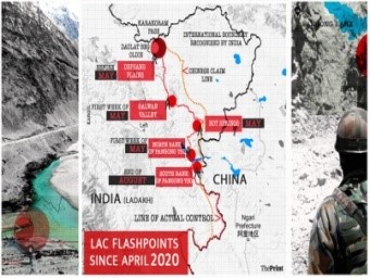
Hot Springs is just north of the Chang Chenmo river and Gogra Post is east of the point where the river takes a hairpin bend coming southeast from Galwan Valley and turning southwest. The area is north of the Karakoram Range of mountains, which lies north of the Pangong Tso lake, and south east of Galwan Valley.
Importance of Hot Springs and Gogra Post : The area lies close to Kongka Pass, one of the main passes, which, according to China, marks the boundary between India and China. India’s claim of the international boundary lies significantly east, as it includes the entire Aksai Chin area as well. Hot Springs and Gogra Post are close to the boundary between two of the most historically disturbed provinces (Xinjiang and Tibet) of China.
RELATED CONCERNS
- Formalize the Chinese Military’s Transgressions: The broader aim of the land border law is to give legal cover and formalize the Chinese military’s transgressions across the LAC (Line of Actual Control) in 2020.
- Fresh Impetus to Civilian Agencies: The law calls for increased settlement of the civilian population and improved infrastructure along the border area. China has previously used the strategy of moving its “civil” population along the contested part of the LAC on the basis of which it claims rightful ownership. The new law might increase such instances and create further problems between the two countries.
- Limiting the Water Flow: There is also the possibility of limiting the water flow in the Brahmaputra or Yarlung Zangbo river which flows from China into India as the law calls for “measures to protect the stability of cross-border rivers and lakes”. China might cite this provision in case of hydropower projects which may cause ecological disaster in India and call it a lawful action on its part.
China's Border Disputes:
- China has a 22,100-kilometer land border with 14 countries.
- It has resolved the boundary disputes with 12 neighbors.
- India and Bhutan are the two countries with which China is yet to finalize the border agreements.
- China and Bhutan signed an MOU firming up a three-step roadmap for expediting the boundary negotiations.
- India-China border disputes cover 3,488-km along the Line of Actual Control, China-Bhutan dispute covers about 400 km.
MAJOR FRICTION POINTS
- Apart from PP15 and PP17A, PP14 in Galwan Valley, and Finger 4 on the north bank of Pangong Tso and Rezang La and Rechin La on the south bank of Chang Chenmo river, were identified as friction points.
- Pangong Tso lake: Pangong Lake is located in the Union Territory of Ladakh. It is situated at a height of almost 4,350m and is the world’s highest saltwater lake. Extending to almost 160km, one-third of the Pangong Lake lies in India and the other two-thirds in China.
- Galwan Valley: The valley refers to the land that sits between steep mountains that buffet the Galwan River. The river has its source in Aksai Chin, on China’s side of the LAC, and it flows from the east to Ladakh, where it meets the Shyok River on India’s side of the LAC. The valley is strategically located between Ladakh in the west and Aksai Chin in the east, which is currently controlled by China as part of its Xinjiang Uyghur Autonomous Region.
- Chang Chenmo River: Chang Chenmo River or Changchenmo River is a tributary of the Shyok River, part of the Indus River system. It is at the southern edge of the disputed Aksai Chin region and north of the Pangong Lake basin. The source of Chang Chenmo is near the Lanak Pass.
- Kongka Pass: The Kongka Pass or Kongka La is a low mountain pass over a hill that intrudes into the Chang Chenmo Valley. It is in the disputed India-China border area in Ladakh.
- Karakoram Range: It is also known as Krishnagiri which is situated in the northernmost range of the Trans-Himalayan ranges. It forms India's frontiers with Afghanistan and China. It extends eastwards from the Pamir for about 800 km. It is a range with lofty peaks [elevation 5,500 m and above]. Some of the peaks are more than 8,000 metre above sea level. K2 (8,611 m) Godwin Austen or Qogir] is the second highest peak in the world and the highest peak in the Indian Union. The Ladakh Plateau lies to the north-east of the Karakoram Range.
PRAVAHINI Current Affairs Notes By Success Mantra Coaching Institute GTB Nagar Delhi CLICK HERE
WHAT IS LINE OF ACTUAL CONTROL?
Demarcation Line: The Line of Actual Control (LAC) is the demarcation that separates. Indian-controlled territory from Chinese-controlled territory.
LAC is different from the Line of Control (LoC) with Pakistan:
The LoC emerged from the 1948 ceasefire line negotiated by the United Nations (UN) after the Kashmir War. It was designated as the LoC in 1972, following the Shimla Agreement between the two countries. It is delineated on a map signed by the Director General of Military Operations (DGMO) of both armies and has the international sanctity of a legal agreement. The LAC, in contrast, is only a concept – it is not agreed upon by the two countries, either delineated on a map or demarcated on the ground.
Length of the LAC: India considers the LAC to be 3,488 km long, while the Chinese consider it to be only around 2,000 km.
CHINA BUILDS NEW BRIDGES ACROSS PANGONG LAKE
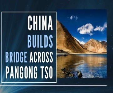
Recently, it was found that China is building a new bridge on Pangong Tso which will provide an additional axis to deploy troops faster between the north and south banks of the lake, and closer to the LAC (Line of Actual Control). Earlier, China’s new law on land borders came into effect from 1st January, 2022, at a time when border standoff in eastern Ladakh remains unresolved and several places in Arunachal Pradesh have been renamed recently by China as part of its claim on the Indian state. India too has been improving its infrastructure in the border areas. In 2021, the Border Roads Organization completed more than 100 projects in border areas, the majority of which were close to the border with China.
Background: Since the military standoff began in May 2020, India and China have not only worked to improve existing infrastructure, but have also built several new roads, bridges, landing strips along the entire frontier. Towards the end of August 2020, India outmaneuvered China to capture the previously unoccupied heights of the Kailash Range on the south bank of Pangong Tso lake. Indian troops positioned themselves on the peaks there, including Magar Hill, Gurung Hill, Rezang La, Rechin La, and this allowed them to dominate the strategic Spanggur Gap — it can be used for launching an offensive, as China had done in 1962 — and also gave them a view of the PLA garrison at Moldo. Indian troops had also positioned themselves above the Chinese troops in the Fingers area on the north bank. During this scramble for the heights, shots had been fired by both sides, a first in over four decades.
Troops from the two countries remained on these heights through the harsh winter months. The significance of these positions was one of the main factors that compelled China to negotiate a pullback. Both countries agreed to a pullback from the north bank of the lake, and positions on the Kailash Range in the Chushul sub-sector south of Pangong Tso.
About: The bridge is being constructed more than 20 km east of Finger 8 on the lake’s north bank – India says Finger 8 denotes the LAC. The Lake is overlooked by the Finger Area - a set of eight cliffs extending out of the Sirijap range (on the northern bank of Lake). Pangong Tso, an endorheic lake, is 135 km long, of which more than two-thirds is under Chinese control. The north and south banks of the lake were among the several friction points that surfaced after the start of the standoff. Before India and China pulled back troops from the north and south banks in February 2021, the area had seen massive mobilization and the two sides even deployed tanks, barely a few hundred meters apart in some locations.
The bridge site is just east of Khurnak Fort in Rutog county where the PLA (People’s Liberation Army) has frontier bases. Historically a part of India, Khurnak Fort has been under Chinese control since 1958. From Khurnak Fort, the LAC is considerably west, with India claiming it at Finger 8 and China claiming it at Finger 4.
SIGNIFICANCE FOR CHINA
The bridge will cut a 180-kilometer loop from Khurnak to the south banks through Rudok reducing the distance between Khurnak and Rudok to 40-50 kilometers, rather than approximately 200 kilometers as previously stated. The building of the bridge will allow it to mobilize its troops faster in this area, hoping to prevent a repeat of what happened in August 2020.
Implication for India: The bridge is in their territory, and the Indian Army will have to factor this in its operational plans. The widening of roads, building of new roads and bridges, new bases, airstrips, advance landing bases, etc are not restricted to the eastern Ladakh region, but are happening across the three sectors of the India-China boundary (Eastern, Middle and Western).
CONCLUSION
The naming of 15 places in Arunachal Pradesh as its own territory by China came as India and China remain engaged at both diplomatic and military levels to complete the stalled disengagement process along the LAC. Restoring relations, as well as the status quo along the borders, will require mutual sensitivity and an adherence to past agreements that helped keep the peace, rather than needless provocations that expand an already long list of differences.


bwkiciyfzz
Latest News on Education & LAW Exams Blogs | Success Mantra <a href="http://www.gh14l459z7xb986tw95o4dqa5a5hf1x0s.org/">abwkiciyfzz</a> [url=http://www.gh14l459z7xb986tw95o4dqa5a5hf1x0s.org/]ubwkiciyfzz[/url] bwkiciyfzz http://www.gh14l459z7xb986tw95o4dqa5a5hf1x0s.org/